
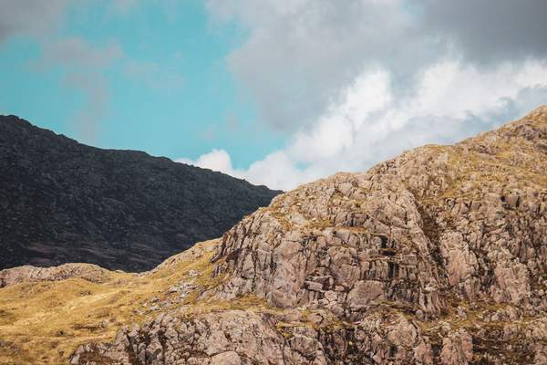
Eryri, the Welsh name now used officially for Snowdonia National Park, offers more than a famous summit. You can spend an afternoon beside an estuary, follow a lakeside circuit beneath towering cliffs or commit to a demanding mountain day. The best Eryri hiking routes fit your experience, the conditions and the time available.
Yr Wyddfa, also known as Snowdon, draws huge attention. But exploring other valleys reveals why Eryri walks suit so many different visitors. Here is how to choose a trail without mistaking a popular path for an easy one.
Gentler Eryri Walks for Beginners
Mawddach Trail: Flexible Distance and Estuary Views
The Mawddach Trail follows a former railway corridor between Dolgellau and the Barmouth area. Its full length is approximately 15 kilometres one way, but several access points make shorter outings possible. You get broad views across the estuary and surrounding hills without a major climb.
The National Park grades this as an Access for All route, with a generally even, level surface. It is appealing for families and casual walkers. Plan your return journey rather than assuming the whole trail is circular.
Lôn Gwyrfai: Woodland and Mountain Scenery
Connecting Rhyd Ddu and Beddgelert, Lôn Gwyrfai offers roughly seven kilometres of woodland, countryside and mountain views. Graded easy by the National Park, it suits walkers comfortable with a longer countryside outing. Parts are shared with cyclists and horse riders.
This is a one-way route, not a loop. Consider public transport for the return leg, and check the latest information because diversions can affect the path. You can enjoy being among the mountains without tackling a summit.
Moderate Routes for Walkers Ready for Rougher Ground
Cwm Idwal: A Dramatic Circuit in the Ogwen Valley
Cwm Idwal is among the most memorable Eryri mountain walks that do not require climbing a summit. The National Park’s circular route is approximately five kilometres, usually estimated at two hours. It leads into a glacial landscape where a dark lake sits beneath enormous rock walls.
Despite its manageable distance, Cwm Idwal is officially graded moderate. Expect uneven or steep sections and surfaces that become slippery in rain. Wear suitable footwear and avoid informal paths up the surrounding scree slopes.
For a first visit, allow extra time for photographs, then reassess the weather at the trailhead. Parking in the Ogwen Valley is limited, so research transport before setting out.
Why Distance Does Not Tell the Whole Story
A five-kilometre mountain circuit can feel tougher than a much longer level trail. Compare total ascent, exposure to wind, footing and opportunities to turn back. Official difficulty grades offer a better starting point than mileage alone.
Strenuous Snowdonia Hiking Routes for Experienced Walkers
Llanberis Path: Gradual but Demanding
The Llanberis Path is often called the easiest way to reach Yr Wyddfa because its ascent is more gradual than the other main routes. That can mislead visitors. The National Park grades it hard/strenuous, with around 14.5 kilometres of walking and approximately 975 metres of ascent on the return hike.
Allow a full mountain day and carry navigation equipment. The path runs near the Snowdon Mountain Railway in places, but walkers must stay off the tracks. This is a choice for fit walkers with mountain experience, not an introductory stroll.
Miners’ Track and Pyg Track: Different Starts, Serious Climbs
Both routes begin at Pen y Pass, yet neither provides an easy summit shortcut. The Miners’ Track initially passes lakes and historic mining remains before climbing steeply over loose rock. The Pyg Track is rugged earlier, with steep steps and rocky mountain scenery.
They converge higher up and require confident navigation, especially in cloud. Study junctions carefully before combining them into a circular outing. Do not accidentally follow routes towards Crib Goch: its knife-edge ridge is a serious mountaineering undertaking.
Cader Idris via Minffordd: A Southern Challenge
For a different setting, consider Cader Idris in southern Eryri. The Minffordd Path passes through Cwm Cau, with views towards Llyn Cau, before climbing onto demanding mountain terrain. The National Park grades this approximately nine-kilometre return route hard/strenuous and recommends strong fitness and navigation skills.
The shorter distance does not make it easy. Significant ascent, rough ground and changing conditions demand proper preparation.
Match a Route to the Day You Have
Ask three questions: How confident are you on uneven ground? How much climbing have you recently done? What conditions are forecast at the highest point? Someone who walks ten kilometres regularly on flat paths may still struggle with a steep ascent.
Imagine a group visiting for two days. On a settled first day, Cwm Idwal could offer a rewarding outing for walkers with some countryside experience. If strong winds arrive on day two, replace a summit attempt with a shorter section of the Mawddach Trail. Changing the objective is good judgement, not a failed trip.
If you hope to progress towards summit walks, practise on lower-level terrain and learn map-and-compass skills first. A first mountain hike checklist and a guide to Welsh walking routes can help organise your preparation.
Practical Planning for Hiking Snowdonia Safely
Mountain forecasts matter more than weather predictions for a nearby village. Check the Met Office mountain forecast, current ground conditions and remaining daylight before leaving. Wind, cloud and winter ice can dramatically change familiar routes.
Take suitable footwear, waterproofs, warm spare layers, food, water, a charged phone and a paper map and compass you know how to use. Tell someone your planned route and return time. Downloaded maps help, but batteries and mobile reception cannot be relied upon everywhere.
Transport is part of route selection. Sherpa’r Wyddfa buses serve several summit trailheads, while Pen y Pass has substantial parking pressure. Check current timetables, parking rules and diversions. Follow established paths and the Countryside Code.
Frequently Asked Questions
What are the best Eryri hiking routes for beginners?
Try a section of the Mawddach Trail or Lôn Gwyrfai. Both offer beautiful scenery without a summit climb. Choose a suitable distance and arrange the return journey.
Is Llanberis Path suitable for complete beginners?
Not generally. Although it is the most gradual main route up Yr Wyddfa, it remains a long, strenuous mountain hike requiring fitness, navigation skills and suitable conditions.
Are Eryri and Snowdonia the same place?
Yes. Eryri is the Welsh name used officially by the National Park Authority, while Snowdonia remains a familiar English name. Yr Wyddfa is the Welsh name for Snowdon.
Can you enjoy Eryri without reaching a summit?
Absolutely. Lakes, woodland, estuaries and valleys provide rewarding outings. Cwm Idwal delivers dramatic mountain scenery on a moderate circuit rather than a summit expedition.
Find the Walk That Fits
There is no single route that represents all of Eryri. A relaxed estuary walk and a rugged summit ascent can be equally memorable for different reasons. Use official route grades, current conditions and an honest assessment of your group’s abilities. The mountains will still be there when you are ready for a harder day.